Pemberton’s original surveys
- Date:
- 1855
- Record:
- Map CM B1549
- Materials:
- linen
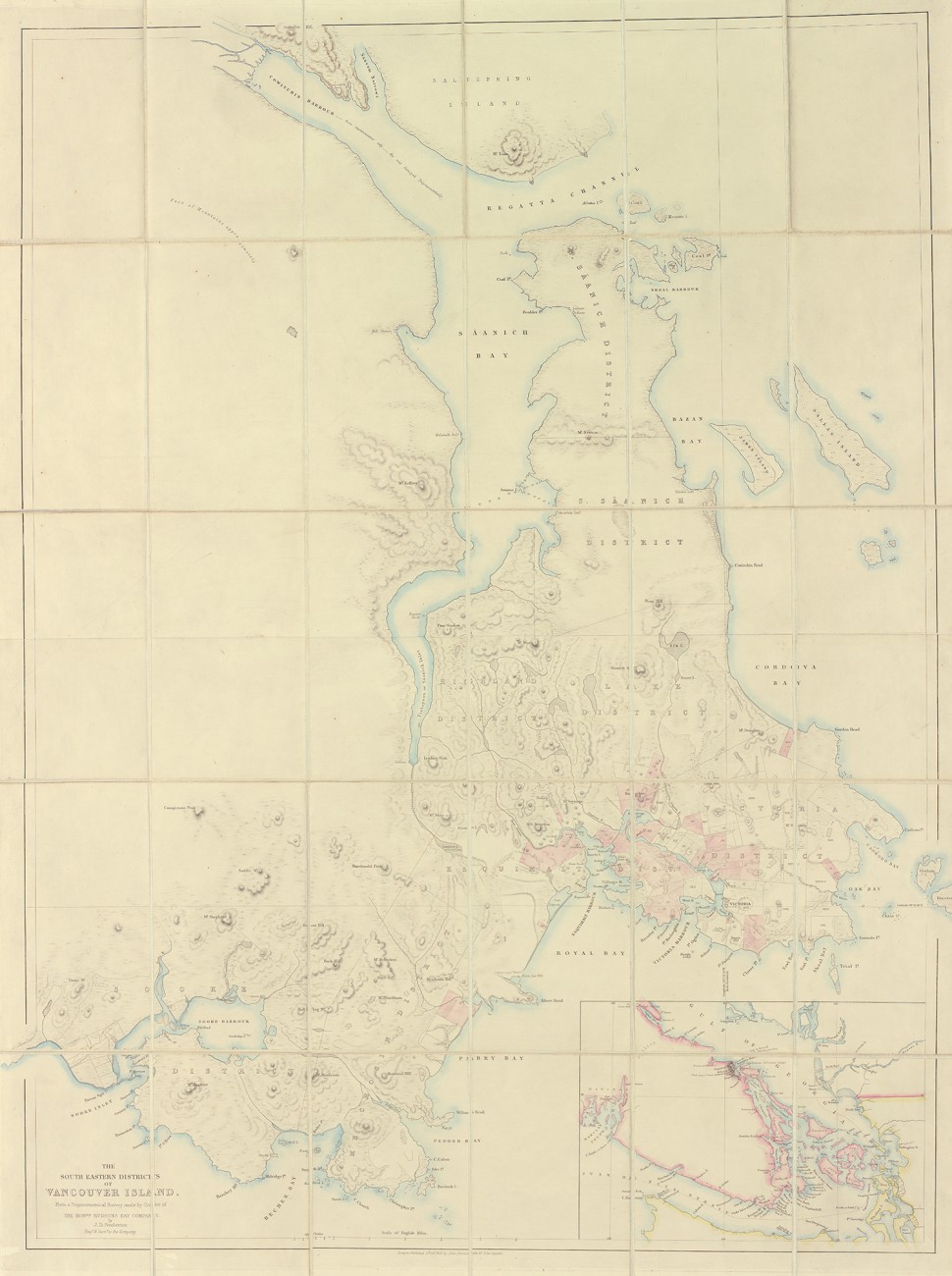
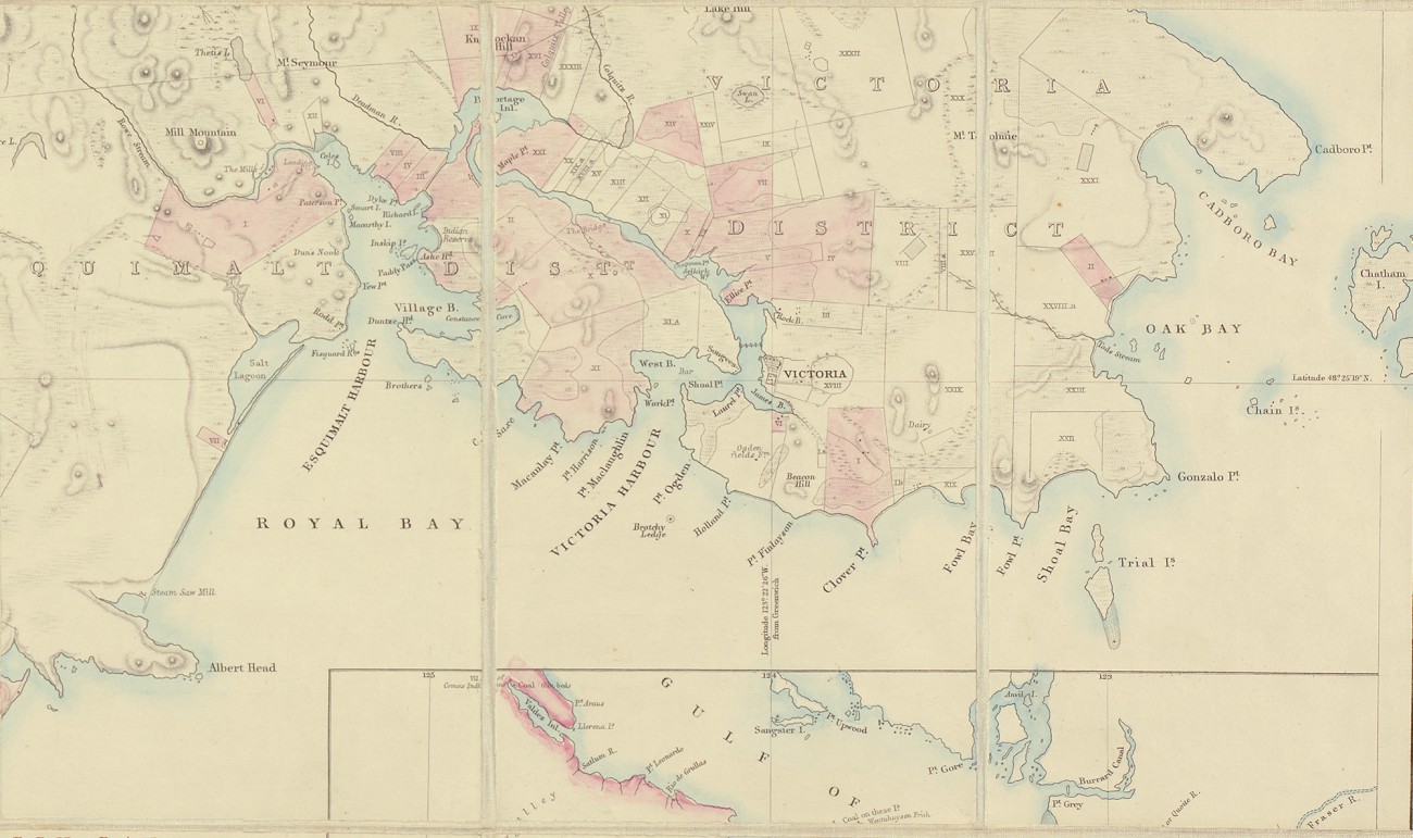
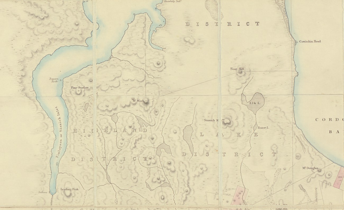
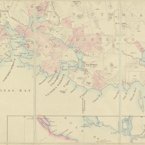
Joseph Despard Pemberton (1821-1873) was instrumental in the early land distribution of southern Vancouver Island. His formal surveys of Victoria and Nanaimo are the areas’ earliest. Illustrated is part of an 1855 map showing some of the first surveyed lots of Victoria. The map, 86 x 67 cm, is drawn at a standard English scale of 1 inch to 1 mile.
As colonial engineer and surveyor for the Hudson’s Bay Company (HBC) from 1851, Pemberton played an integral part in developing southern Vancouver Island. He laid out Victoria’s town site, and surveyed from Sooke to Nanaimo, detailing the topography and natural resources. In 1859, he left the HBC and was appointed surveyor general of Vancouver Island, a post he held until 1864.
As colonial surveyor, Pemberton was in charge of both land surveys and sales. His surveys of southern Vancouver Island were referenced in the Vancouver Island treaties. Richard Mackie has observed that Pemberton sold more than 17,000 acres in five south island districts before the gold rush, as well as another 155 town and suburban lots to 180 colonists.
Although the Colony of Vancouver Island was originally marketed to potential settlers as agricultural land, Pemberton’s early surveys revealed resources were of a wider variety, and agriculture was not the predominant resource.