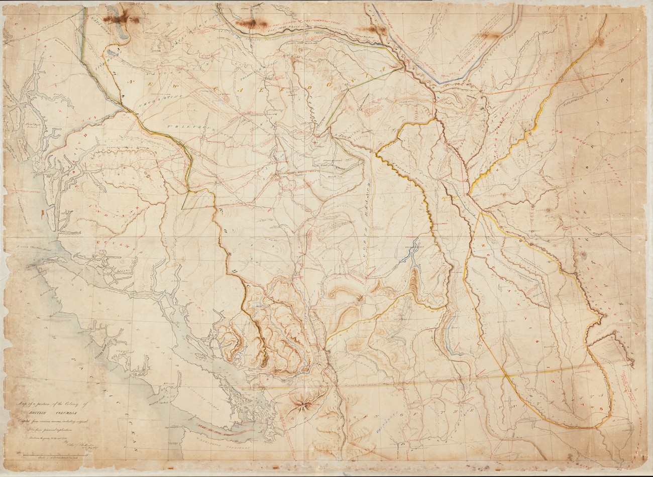
Pre-Confederation map
- Date:
- 1867
- Record:
- CM-F9
- Materials:
- 1.26 m x 1.77 m
British Columbia was still a Crown colony when this map was drawn in 1867, the same year Canadian Confederation was proclaimed. It would be four more years before BC joined the confederation to become Canada’s sixth province.
The map is a compilation of various sources, including original notes from personal exploration between 1832 and 1851 by Alexander Caulfield Anderson (1814-1884). Anderson was a Hudson’s Bay Company (HBC) fur trader, explorer and civil servant. He is commemorated in the naming of Anderson Lake, the Anderson River (a small tributary of the Fraser), and Anderson Island, in Puget Sound near Nisqually.
The map, 1.26 x 1.77 m, is brilliantly coloured to note Indigenous settlements, telegraph lines, trails used by the HBC and all of its trading posts. It also depicts the routes Anderson explored in 1846-47 while trying to find a new all-British route to the Pacific, following the 1846 boundary settlement and subsequent establishment of the 49th parallel as the Canadian-American border.
The map was offered to the Government of British Columbia as payment for a considerable debt – taxes and arrears totaling about $1,000 – owed on his farm in North Saanich.